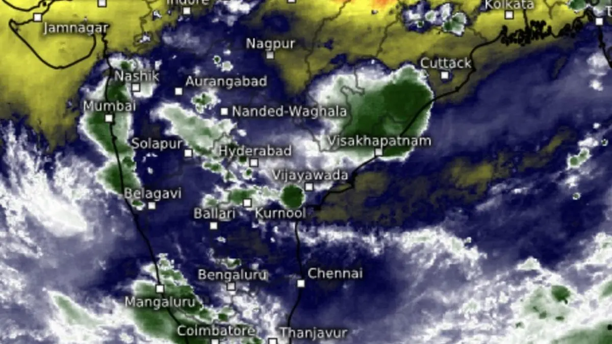

Thunderstorms bloomed over Kerala, Konkan and Mumbai along the West Coast and Odisha coast as well as parts of central India on Wednesday even as the onset of the monsoon is expected over the mainland next week.
| Photo Credit:
www.meteologix.com/in
The India Meteorological Department (IMD) and global forecast models see a spectacular onset of the monsoon, with swarms of precursor thunderstorms raiding the Konkan/ Mumbai to Kerala coast with ferocity over the next few days. The monsoon is forecast to reach the mainland (Kerala coast) by May 27, with a model error of four days on either side.
The Arabian Sea arm of the monsoon that blasts its way into the Maldives and Sri Lanka and subsequently Kerala, may make a better impression initially on mainland India than in the Bay of Bengal arm that eyes its east and north-eastern region, according to an outlook from the European Centre for Medium-Range Weather Forecasts valid for the next 10-15 days.
Likely vortex off coast
The flourish could likely be overseen by a vortex-like formation just off the Konkan coast, after the Bay arm forfeits its early advantage in the onset phase. The bay may have to wait a little longer for a circulation to fire away and manage its own flows.
A monsoon vortex, also called the monsoon onset vortex, is a cyclonic circulation or low-pressure area that plays a key role in the onset. A vortex forms over the seas with maximum surface temperature that aids intense convection and cloud formation.
Warm ocean pool
On Wednesday evening, the warmest waters with temperatures of up to 31℃ (way beyond of threshold 27.5℃ that sustains low-pressure areas/ storms) extended from the South-East Arabian Sea around Lakshadweep and off the north Kerala coast to Mumbai.
Very warm pools of water were also present over the Bay off the Tamil Nadu and Andhra Pradesh coasts, and further into central Bay, around the Andaman and Nicobar Islands, and extreme south-east Bay waters, washing up along the Myanmar coast.
Robust onset seen
The US National Weather Service/ Climate Prediction Centre said dynamical model forecasts support a robust onset of the monsoon, with enhanced chances for above-normal precipitation extending during the next two weeks (May 21 to 27 and May 28 to June 3.)
This phase also raises prospects for the formation of a storm off the Philippines in the north-west Pacific – which falls under the larger monsoon trough that regulates rainfall – as also over the Bay. It remains to be seen if these two complement each other or one gives in to the other in strength, and with it a larger share of moisture, in a typical tit-for-tat session between competing systems.
Published on May 14, 2025
Anurag Dhole is a seasoned journalist and content writer with a passion for delivering timely, accurate, and engaging stories. With over 8 years of experience in digital media, she covers a wide range of topics—from breaking news and politics to business insights and cultural trends. Jane's writing style blends clarity with depth, aiming to inform and inspire readers in a fast-paced media landscape. When she’s not chasing stories, she’s likely reading investigative features or exploring local cafés for her next writing spot.
- ANURAG DHOLEhttps://indiatadkha.com/author/bitlancetechhubgmail-com/

- ANURAG DHOLEhttps://indiatadkha.com/author/bitlancetechhubgmail-com/
- ANURAG DHOLEhttps://indiatadkha.com/author/bitlancetechhubgmail-com/
- ANURAG DHOLEhttps://indiatadkha.com/author/bitlancetechhubgmail-com/