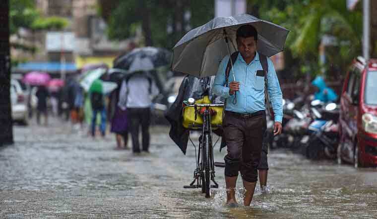
Mumbai Weather Update: Heavy rain accompanied by thunder and lightning swept across several parts of Mumbai on Tuesday evening, slowing down traffic and disrupting daily life, particularly in the suburbs.
According to officials, the intensity of this pre-monsoon spell was much higher in the eastern and western suburbs compared to the island city, which recorded only light showers. In the western suburbs, Jogeshwari witnessed the heaviest rainfall at 63 mm by 8 pm, followed by Andheri (Malpa Dongri) at 57 mm and Andheri (East) at 40 mm, PTI reported.
Meanwhile, in the eastern belt, Powai topped the charts with 38 mm of rainfall, followed by Bhandup (S ward office) at 29 mm and Tembhi Pada with 27 mm. Between 8 pm and 11 pm, Mumbai recorded light to moderate rain.
According to Brihanmumbai Municipal Corporation (BMC) officials, the island city saw an average of 12.86 mm rainfall, while the eastern and western suburbs recorded 15.65 mm and 26.63 mm, respectively.
#WATCH | Maharashtra | The traffic slows down on Western Express Highway following heavy rain across Mumbai. pic.twitter.com/jxnK25lUS5
— ANI (@ANI) May 20, 2025
Mumbai Rain: Isolated waterlogging, no major incidents
Despite the heavy spell, officials said there were no reports of serious disruptions. “Except one incident of tree fall and one of short circuit, no other incident was reported in the metropolis,” they said.
However, the traffic police reported waterlogging near the Andheri subway, which forced them to halt vehicular movement temporarily. Some commuters said road traffic had slowed considerably due to the rain. Local train services, according to Railway authorities, remained unaffected, though some passengers reported minor delays.
Mumbai Rain: Heavy rain forecast till May 24 due to cyclonic circulation
The India Meteorological Department (IMD) has forecast more rainfall in the coming days. A cyclonic circulation is likely to develop over the east-central Arabian Sea off the Karnataka coast, which could influence weather across Maharashtra between May 21 and 24.
“A low-pressure area is likely to form over the same region around May 22, and thereafter, it may move northwards and intensify further,” said the Regional Meteorological Centre, Mumbai, in a release issued Tuesday evening.
“Rainfall activity over Maharashtra may increase between May 21 and May 24 under the influence of the cyclonic circulation,” Met department official Shubhangi Bhute added.
She also warned that the weather system may affect parts of Maharashtra, including south Konkan, south central Maharashtra and Mumbai. “There is a possibility of heavy rainfall with thunder at some places, accompanied by gusty winds reaching speeds of 30-40 kmph or possibly higher at isolated locations,” Bhute said.
(With inputs from PTI)
Anurag Dhole is a seasoned journalist and content writer with a passion for delivering timely, accurate, and engaging stories. With over 8 years of experience in digital media, she covers a wide range of topics—from breaking news and politics to business insights and cultural trends. Jane's writing style blends clarity with depth, aiming to inform and inspire readers in a fast-paced media landscape. When she’s not chasing stories, she’s likely reading investigative features or exploring local cafés for her next writing spot.
- ANURAG DHOLEhttps://indiatadkha.com/author/bitlancetechhubgmail-com/

- ANURAG DHOLEhttps://indiatadkha.com/author/bitlancetechhubgmail-com/
- ANURAG DHOLEhttps://indiatadkha.com/author/bitlancetechhubgmail-com/
- ANURAG DHOLEhttps://indiatadkha.com/author/bitlancetechhubgmail-com/